In short:
To address the challenge of off-road vehicle traversability through dense vegetated environments such as orchards, vineyards, and forests, we explore the potential of a multispectral camera. The data provided in the near-infrared wavelengths open the door to new scientific approaches based on the spectral emissions of vegetation. The initial results of our work are described in this article.
Abstract:
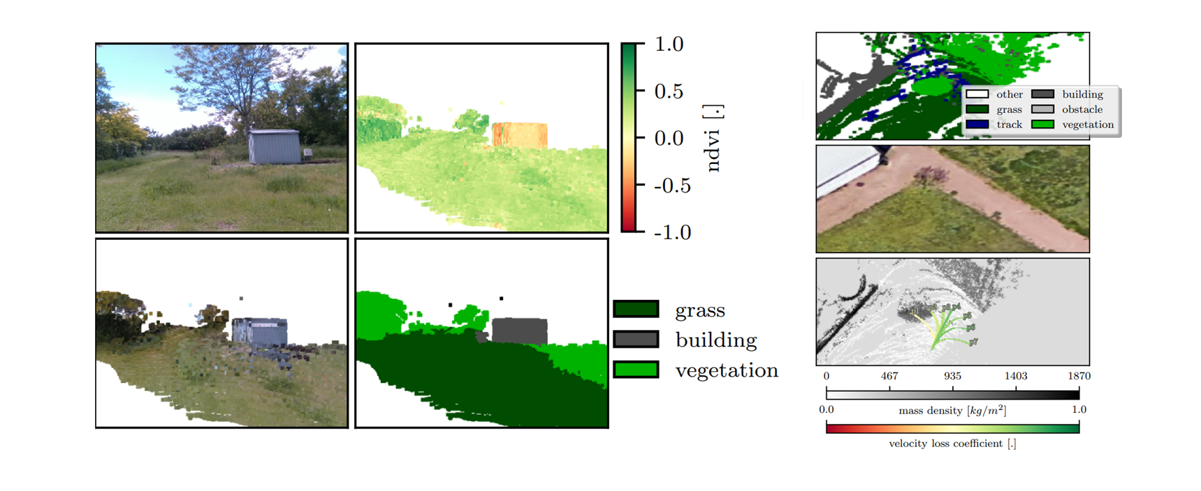
In this paper, we introduce a novel method for safe navigation in agricultural robotics. As global environmental challenges intensify, robotics offers a powerful solution to reduce chemical usage while meeting the increasing demands for food production. However, significant challenges remain in ensuring the autonomy and resilience of robots operating in unstructured agricultural environments. Obstacles such as crops and tall grass, which are deformable, must be identified as safely traversable, compared to rigid obstacles. To address this, we propose a new traversability analysis method based on a 3D spectral map reconstructed using a LIDAR and a multispectral camera. This approach enables the robot to distinguish between safe and unsafe collisions with deformable obstacles. We perform a comprehensive evaluation of multispectral metrics for vegetation detection and incorporate these metrics into an augmented environmental map. Utilizing this map, we compute a physics-based traversability metric that accounts for the robot's weight and size, ensuring safe navigation over deformable obstacles.


